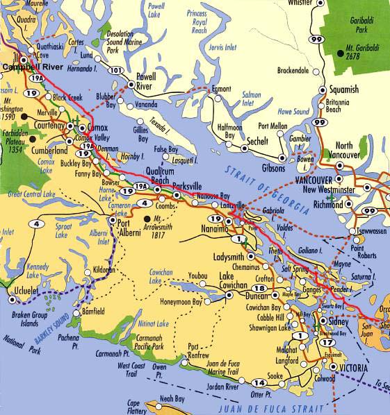
Map of Vancouver Island, with our route in red.
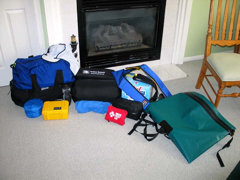
Gear. This trip is all about camping gear. Randy came over a week early with a list of the items I would need, such as a rubber dry or river bag (green, lower right) to put everything in as I was guaranteed that things would get wet otherwise. I also bought a new sleeping bag, sleeping pad, and much more from REI, making three trips to their Seattle store in as many days. An Advanced Double Bivy bag from Outdoor Research (OR) in Seattle completed the gear. I did not bring a computer, but I did bring my Canon PowerShot G3 digital camera, a Garmin GPSmap76, and a pair of Leica binoculars. I also brought an iPod and HP48 but never used them.
Here is my gear in my family room before leaving, prepared for a month at sea.
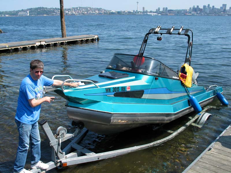
The trip began at the Don Armeni boat ramp near Alki Point in Seattle on a Tuesday morning. Here is Captain Randy Lousberg launching his New Zealand built Stabicraft 1850, an 18' aluminum hulled boat with 7 airtight chambers, a kind of aluminum Zodiac if you will. You can swamp it with water and it will still float.
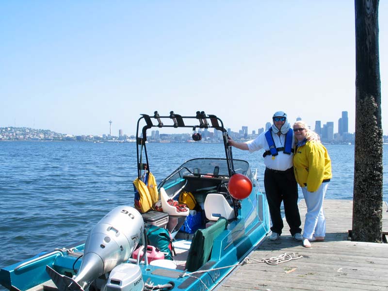
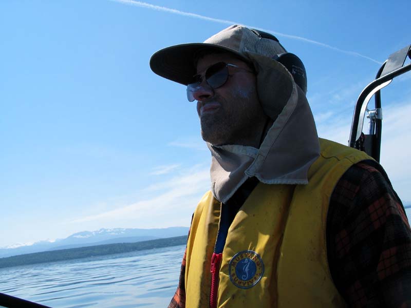
The boat is powered by a Honda 90 outboard 4-stroke engine, and has a Honda 8 hp kicker motor as a backup. We carried enough food and supplies for a month. The boat has an internal fuel tank of 36 gallons, with an extra 15 gallons of fuel in 3 jerry cans. The boat cruises at up to 25 knots and has a cruising range of up to 150 nmi. Here I am wearing two important pieces of safety gear: an inflatable type 3 life jacket, and a hat which covers my neck and head from the sun. I felt like I should be on a camel, but the OR hat was a lifesaver.
Lv 3 Jun 2003 11:48 AM  N47.59285° W122.38220°  Alki Point, Seattle, WA
Ar 3 Jun 2003  3:53 PM  N48.22262° W122.68713°  Coupeville, Whidby Island, San Juans, WA
     → 39.7 nmi @ 9.7 knots at 342°
Our first day's run, after leaving about noon, was to a sleepy little town called Coupeville on Whidby Island.
On the way up the east coast of Whidby Island we saw lots of bald eagles on the shore at low tide. I am puzzled at
what they would be looking for, but we saw at least six or eight birds standing at the edge of the surf at low tide.
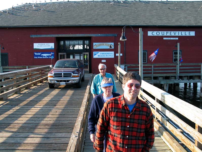
Randy's wife Arlene has an Aunt Evelyn that lives in Coupeville in a restored 1889 parsonage house just a few blocks from the dock. We walked up to their house and were treated by great hospitality: lunch, dinner, a show, and private bedrooms! The show was a free rehearsal of the Shifty Sailors, a singing group of 15 men that were wonderful. Their nautical sea songs put us in the proper mood for the trip.
Here we are leaving the dock and heading back to the house, with Captain Randy in the front, followed by Aunt Evelyn, and Uncle Rod Grant.
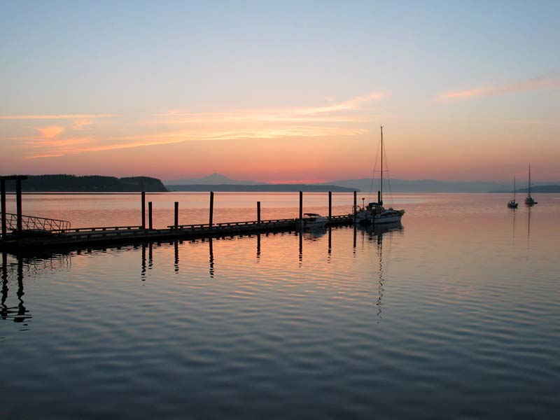
The Captain woke me up at 4:50 AM saying it was time to go. We quietly slipped out of the house and walked down to the dock with nobody else around. Here is our view as we left at 5:15 AM from Coupeville for our next leg. The waters were like glass and we were excited to get moving!
Lv 4 Jun 2003  5:15 AM  N48.22262° W122.68713°  Coupeville, Whidby Island, San Juans, WA
Ar 4 Jun 2003  8:15 AM  N48.67763° W123.19843°  Prevost Harbor, Stuart Island, San Juans, WA
     → 34.0 nmi @ 11.3 knots at 323°
The waters turned rough in Boundary Pass at the north end of the San Juan Islands.
We got completely soaked through and it was time to take a breather, so we pulled into
Stuart Island about 8 AM.
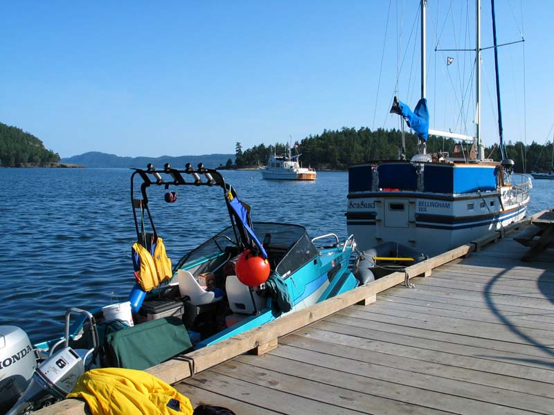
Here Randy made us a great breakfast: pancakes, bacon, hash browns, and a fried egg. He cooked
it on a propane stove right on the dock. We kept looking out of Prevost Harbor to see if the
whitecaps had stopped, which they finally did about 1:00 PM.Here is a view out towards the whitecaps. The mountain in the background is Canada, South Pender Island to be specific. The boat in the foreground is ours, my yellow coat is on the dock drying out from being soaked, and the sailboat in front of us is Sea Sund, a SeaFinn 41 which looks remarkably like a Nauticat clone.
Lv 4 Jun 2003  1:21 PM  N48.67763° W123.19843°  Prevost Harbor, Stuart Island, San Juans, WA
Ar 4 Jun 2003  1:42 PM  N48.74710° W123.22810°  Bedwell Harbour (Customs), Gulf Islands, BC
     → 4.3 nmi @ 12.3 knots at 344°
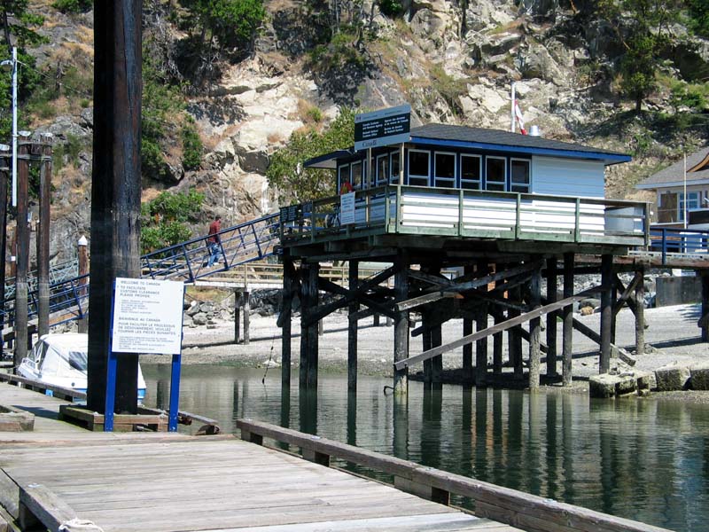
We raced straight across the Pass and into Canada. Bedwell Harbour was our first
stop, a customs dock where we spent some time due to Randy's 458 bear gun. C$100 and we got
in, but not without them examing the boat, the gun, and the ammo.Here you can see Randy walking up to the customs house, while by law I stayed aboard the boat unti we were cleared.
Lv 4 Jun 2003  2:12 PM  N48.74710° W123.22810°  Bedwell Harbour (Customs), Gulf Islands, BC
Ar 4 Jun 2003  4:52 PM  N49.16668° W123.93383°  Nanaimo (K dock), Vancouver Island, BC
     → 37.5 nmi @ 14.1 knots at 312°
After leaving Canadian customs we were off to Nanaimo. We went through Dodd Narrows with
a 7.8 knot current, quite an experience! It looks like river rafting, but it is fairly deep.
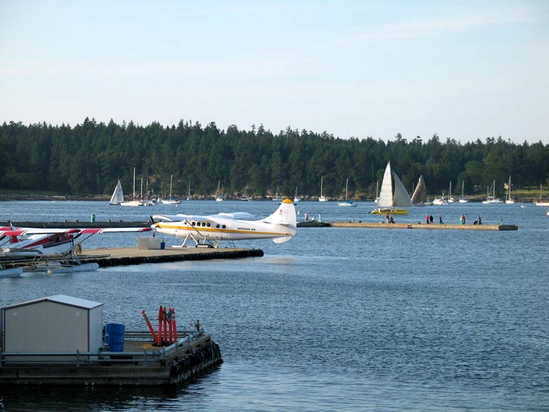
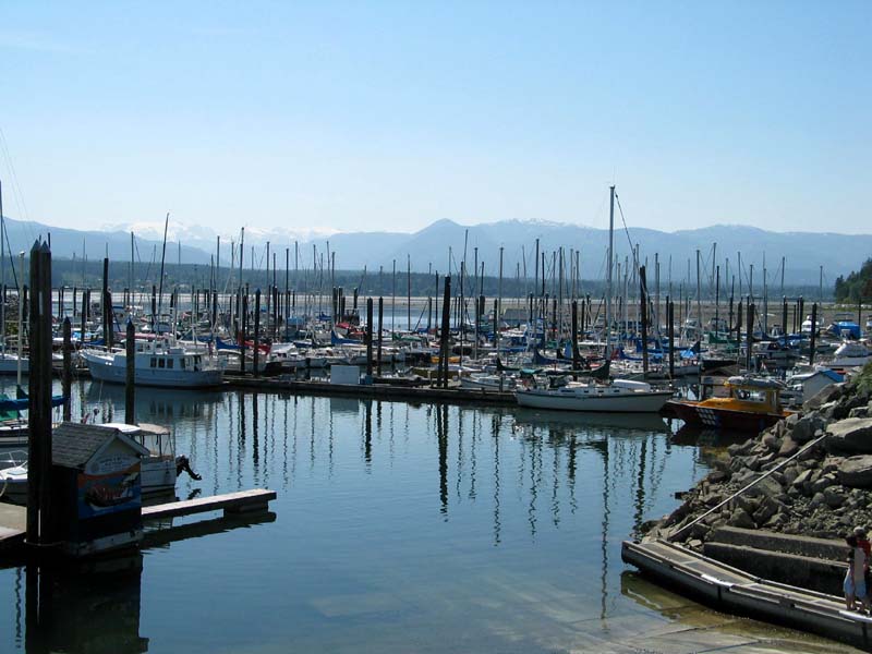
That brought us to Nanaimo and its large harbor. We stopped at the marina and walked up to
a Wendy's for dinner, got some Canadian cash from an ATM, and bought a few snacks at a store.
Did you know that CheezIts are hard to find in Canada?Here is a view of part of the Nanaimo harbor (lots of Kenmoore Air seaplanes), and in the distance is Newcastle Island, where we stayed the night.
Lv 4 Jun 2003  7:18 PM  N49.16668° W123.93383°  Nanaimo (K dock), Vancouver Island, BC
Ar 4 Jun 2003  7:33 PM  N49.18282° W123.92900°  Newcastle Island Marine Park, BC
     → 1.0 nmi @ 4 knots at 11°
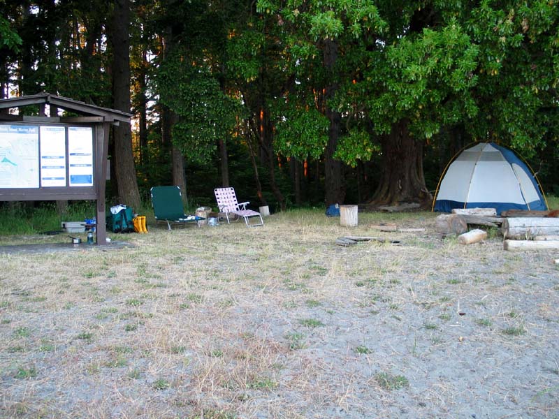
We motored across the harbor to Newcastle Island Marine Park where we joined hundreds of
school kids in camping in a forest, a sea of dome tents.
There were lots of deer and geese and a few rabbits as well.
There are also a unique population of albino raccoons on the island, but we did not see them.
Here is a view from the island back to Nanaimo. Our boat is at the dock, the nearest boat in the photo.
Lv 5 Jun 2003  6:48 AM  N49.18282° W123.92900°  Newcastle Island Marine Park, BC
Ar 5 Jun 2003  7:00 AM  N49.16948° W123.92955°  Nanaimo (Fuel Dock), Vancouver Island, BC
     → 0.8 nmi @ 4 knots at 182°
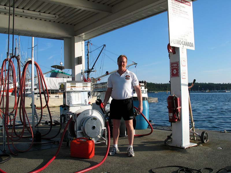
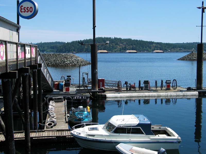
We arose at 5:30 AM, struck camp, and hauled everything back to the boat. We then
headed back across the bay to the fuel dock in Nanaimo and filled up with fuel. Fuel docks
are an important place for the trip: fuel, restrooms, telephone calls on calling cards to adoring yet
worried wives, candy, cold Pepsis, water, and other necessities are all obtained at a fuel dock.Here is Bruce L'Heureux of Gabe's Petro-Canada Marine at the fuel dock, who knew Randy from previous trips! We used 147 Liters at C$0.799/L, which is about US $2.20/gallon.
Lv 5 Jun 2003  7:12 AM  N49.16948° W123.92955°  Nanaimo (Fuel Dock), Vancouver Island, BC
Ar 5 Jun 2003  9:00 AM  N49.28702° W124.13440°  Schooner Cove, Vancouver Island, BC
     → 10.7 nmi @ 5.9 knots at 311°
We headed out and experienced the same thing as the day before: strong morning winds, followed by a
weakening of the winds (and thus waves) in the afternoon. We got beat up again and took to a protected
marina at Schooner Cove only a few miles north of Nanaimo. We grabbed a bite to eat and set out
our chairs on the dock and took a long nap, which I needed after these early morning departures!
This was our view looking out to the Strait of Georgia, with the Canadian mainland in the background across about 10 miles of the Strait.
Lv 5 Jun 2003 12:18 PM  N49.28702° W124.13440°  Schooner Cove, Vancouver Island, BC
Ar 5 Jun 2003  2:30 PM  N49.67015° W124.92958°  Comox, Vancouver Island, BC
     → 38.6 nmi @ 17.5 knots at 307°
Once again the winds died after noon, and we got underway, up the west side of the Strait of
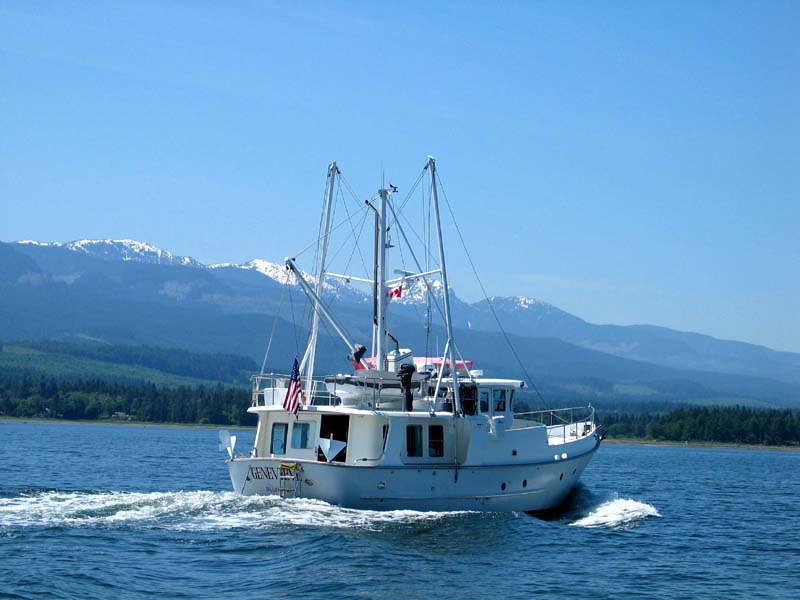
George, to Baynes Sound west of Denman Island. Here our crusing became much smoother and
faster.While in the sound we saw this: a Nordhavn 46 like I used to have! It was Geneveve out of Bellingham. For a minute I missed my Visual Sea.
Lv 5 Jun 2003 12:18 PM  N49.28702° W124.13440°  Schooner Cove, Vancouver Island, BC
Ar 5 Jun 2003  2:30 PM  N49.67015° W124.92958°  Comox, Vancouver Island, BC
     → 38.6 nmi @ 17.5 knots at 307°
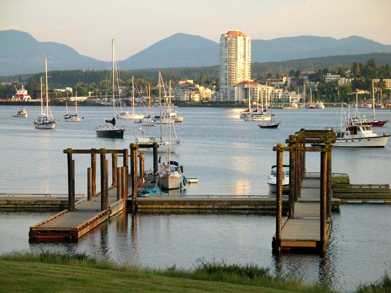
We zipped up to the Comox Marina. It was very hot the minute we got into the protected marina.
It turned out to be around 90°F. We stopped at the Edge Pub for a burger (Randy) and quesadillas (me)
and when we returned to the boat we saw that our friend the Nordhavn had made it in.This view is of the Comox Marina, looking across west to Courtenay. In the distance is a Vancouver Island glacier which is melting and predicted to be gone in 25 years. Vancouver Island is huge. It feels like the mainland.
Lv 5 Jun 2003  4:00 PM  N49.67015° W124.92958°  Comox, Vancouver Island, BC
Ar 5 Jun 2003  4:30 PM  N49.61813° W124.85087°  Sandy Island Marine Park, BC
     → 4.4 nmi @ 8.8 knots at 136°
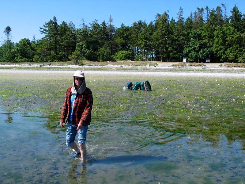
Things then got very retro. After we left Comox we headed back a few miles to Sandy Island.
Sandy Island is where the Canadian troups trained in WWII for their South Pacific beach landings.
It is a marine park now, but some structures can still be seen from WWII days.We made our own assalt upon the island at low tide. We anchored the boat and waded our supplies ashore: tents, stoves, food, water, clothes, sleeping bags, cots, sleeping pads. It was hot. Hiking in sand is difficult. Our destination is back behind the signs at the edge of the forest. This activity about killed me, but Randy handled it without any problem.
After what seemed like hours of work, we settled in. I sat, completely exhausted. I suddenly became much more appreciative of George Vancouver and Captain Cook and others who had explored this area many years ago. Exploration is hard work!
Randy cooked us some steaks and hash browns. The mosquitos were about, as well as a bunch of 8th grade kids that had kyacked from across the water for a school trip. They made lots of noise until midnight.
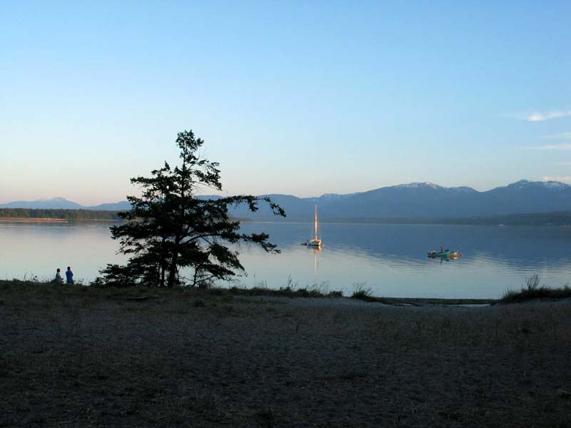
Here you can see sunset at Sandy Island, with Vancouver Island in the background, and with Randy talking to one of the kids parents in the lower left. Our boat is to the right, now very well out to sea. It was hooked to a loop line anchor system that allowed us to pull the boat back in when needed.
It was very hot, as previously mentioned. I ended up sleeping on my cot, the green Costco device which doubles as a lounge chair, as seen here. An eagle's nest was very close to our camp, and it made lots of neat screeching noises.
Lv 6 Jun 2003 10:00 AM  N49.61813° W124.85087°  Sandy Island Marine Park, BC
Ar 6 Jun 2003 11:57 AM  N50.03613° W125.24523°  Campbell River (Fuel Dock), Vancouver Island, BC
     → 29.4 nmi @ 15.1 knots at 329°
We arose a bit later and left by 10 AM for Campbell River, our farthest point north. We made
pretty good time and had lunch at Joey's Only Seafood near the dock at greater than 50° North!
I had fish and chips and clams. It was an air conditioned place and it felt wonderful. I am afraid I
am a man that enjoys these creature comforts a lot.Here is the fuel dock at Campbell River. In the distance is a tug pulling three barges full of sawdust. Our boat is pointing right at the camera. It was here that I told Randy that I needed to come home due to the camping and hauling of camping gear being too much for me, so we turned around and headed home.
Lv 6 Jun 2003  2:15 PM  N50.03613° W125.24523°  Campbell River (Fuel Dock), Vancouver Island, BC
Ar 6 Jun 2003  6:08 PM  N49.16948° W123.92955°  Nanaimo (Fuel Dock), Vancouver Island, BC
     → 72.9 nmi @ 18.8 knots at 135°
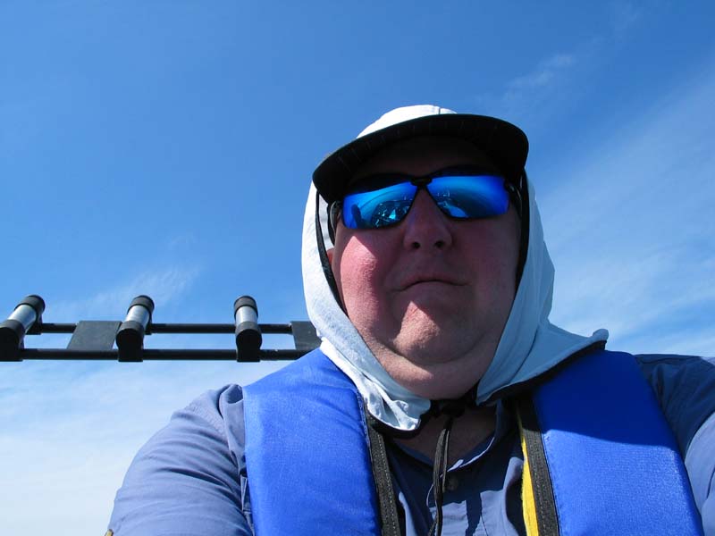
We sped home at a very fast pace, usually around 23 knots. Here is Captain Randy Lousberg
southbound.
Here is First Mate Dan Allen, a self-portrait.
Lv 6 Jun 2003  6:45 PM  N49.16948° W123.92955°  Nanaimo (Fuel Dock), Vancouver Island, BC
Ar 6 Jun 2003 10:35 PM  N48.40115° W122.62513°  Cornet Bay, Whitby Island, San Juans, WA
     → 69.2 nmi @ 18.1 knots at 132°
We stopped for gas at Nanaimo again, and then continued on through Dodd Narrows and south.
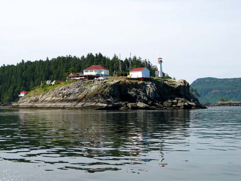
Here is the Chrome Island lighthouse at the South end of Denman Island.
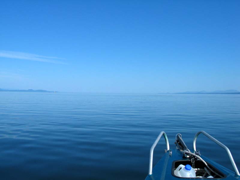
Randy called this view "the end of the world". This is heading South in the Strait of Georgia . Randy would say of this "nice sea state". The sea state is a huge factor in the kind of progress that this boat would make.
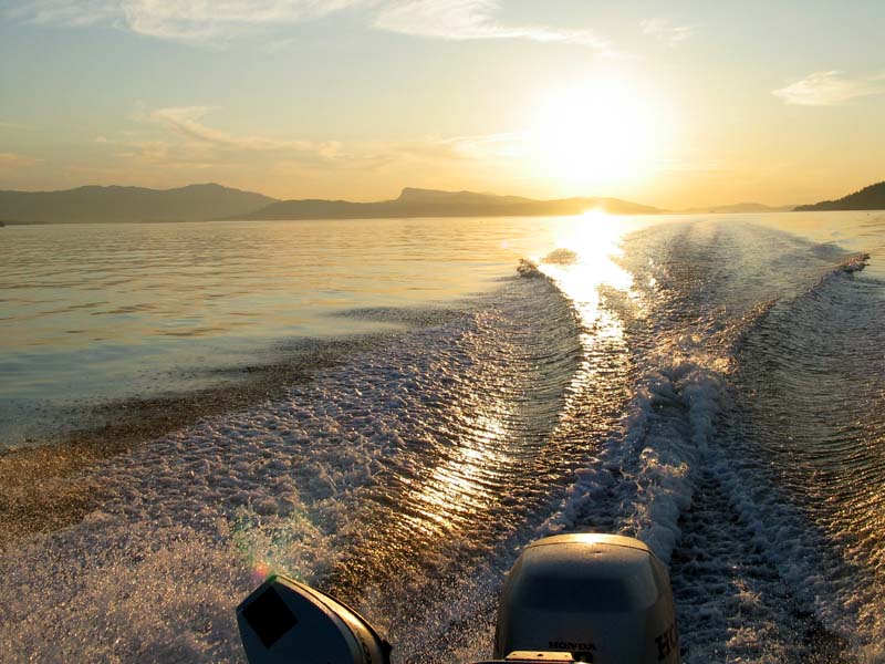
We headed into the San Juans and the United States as sunset neared. We were able to clear customs by simply making a phone call from the Nanaimo fuel dock, which was very slick. We gave them a code number given to us by Canada when we went into Canada. The two countries now share a common database so that all of the info we gave to the Canadians can simply be looked up by the Americans. Very slick.
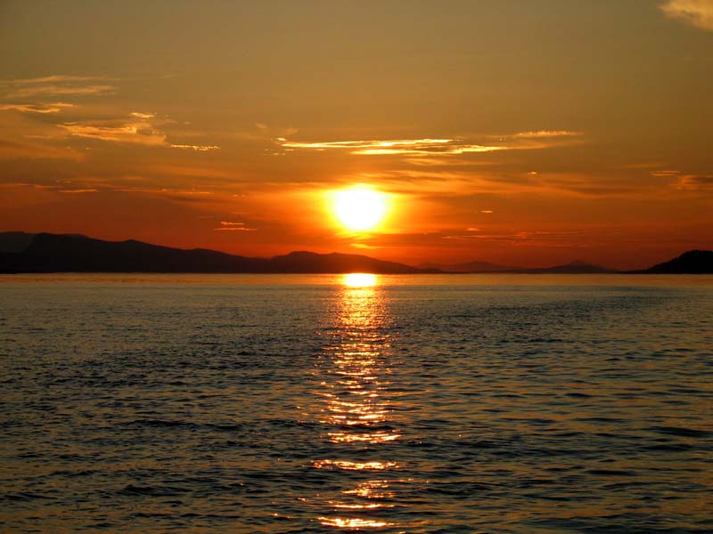
This is our last look at Canada. We are about on the US/Canada border at this moment. The sunet was gorgeous.
Back to the San Juan Islands of Washington. We headed for Jones Island to stay the night, but its dock was full, so we went to James Island, and its dock was full. The sun had set but we could still see things so we went across Rosario Strait all alone late in the evening and went through Deception Pass about 10:15 PM and got into Cornet Bay at 10:35 PM. Its dock was full as well (6 loud party boats) but we found space on a separate floating dock and slept on our cots on the dock.
Did I mention the sunsets were spectacular?
Lv 7 Jun 2003  4:30 AM  N48.40115° W122.62513°  Cornet Bay, Whitby Island, San Juans, WA
Ar 7 Jun 2003  7:20 AM  N47.59285° W122.38220°  Alki Point, Seattle, WA
     → 49.5 nmi @ 17.5 knots at 169°
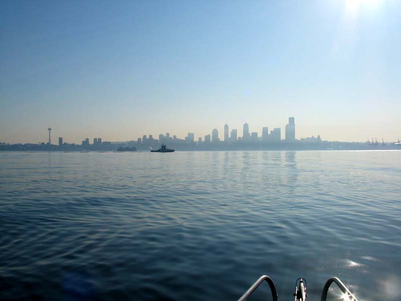
We got up very early again and returned to Seattle. Here is the Space Needle (left) and a Foss tug (center) and the
Seattle skyline (right). It was nice to be back home but as soon as I was in the car and on my way home I missed it all.
I can't wait to return -- all the way to Alaska -- in my boat sometime.
Lv 3 Jun 2003 11:48 AM  N47.59285° W122.38220°  Alki Point, Seattle, WA
Ar 3 Jun 2003  3:53 PM  N48.22262° W122.68713°  Coupeville, Whidby Island, San Juans, WA
     → 39.7 nmi @ 9.7 knots at 342°
Lv 4 Jun 2003  5:15 AM  N48.22262° W122.68713°  Coupeville, Whidby Island, San Juans, WA
Ar 4 Jun 2003  8:15 AM  N48.67763° W123.19843°  Prevost Harbor, Stuart Island, San Juans, WA
     → 34.0 nmi @ 11.3 knots at 323°
Lv 4 Jun 2003  1:21 PM  N48.67763° W123.19843°  Prevost Harbor, Stuart Island, San Juans, WA
Ar 4 Jun 2003  1:42 PM  N48.74710° W123.22810°  Bedwell Harbour (Customs), Gulf Islands, BC
     → 4.3 nmi @ 12.3 knots at 344°
Lv 4 Jun 2003  2:12 PM  N48.74710° W123.22810°  Bedwell Harbour (Customs), Gulf Islands, BC
Ar 4 Jun 2003  4:52 PM  N49.16668° W123.93383°  Nanaimo (K dock), Vancouver Island, BC
     → 37.5 nmi @ 14.1 knots at 312°
Lv 4 Jun 2003  7:18 PM  N49.16668° W123.93383°  Nanaimo (K dock), Vancouver Island, BC
Ar 4 Jun 2003  7:33 PM  N49.18282° W123.92900°  Newcastle Island Marine Park, BC
     → 1.0 nmi @ 4 knots at 11°
Lv 5 Jun 2003  6:48 AM  N49.18282° W123.92900°  Newcastle Island Marine Park, BC
Ar 5 Jun 2003  7:00 AM  N49.16948° W123.92955°  Nanaimo (Fuel Dock), Vancouver Island, BC
     → 0.8 nmi @ 4 knots at 182°
Lv 5 Jun 2003  7:12 AM  N49.16948° W123.92955°  Nanaimo (Fuel Dock), Vancouver Island, BC
Ar 5 Jun 2003  9:00 AM  N49.28702° W124.13440°  Schooner Cove, Vancouver Island, BC
     → 10.7 nmi @ 5.9 knots at 311°
Lv 5 Jun 2003 12:18 PM  N49.28702° W124.13440°  Schooner Cove, Vancouver Island, BC
Ar 5 Jun 2003  2:30 PM  N49.67015° W124.92958°  Comox, Vancouver Island, BC
     → 38.6 nmi @ 17.5 knots at 307°
Lv 5 Jun 2003  4:00 PM  N49.67015° W124.92958°  Comox, Vancouver Island, BC
Ar 5 Jun 2003  4:30 PM  N49.61813° W124.85087°  Sandy Island Marine Park, BC
     → 4.4 nmi @ 8.8 knots at 136°
Lv 6 Jun 2003 10:00 AM  N49.61813° W124.85087°  Sandy Island Marine Park, BC
Ar 6 Jun 2003 11:57 AM  N50.03613° W125.24523°  Campbell River (Fuel Dock), Vancouver Island, BC
     → 29.4 nmi @ 15.1 knots at 329°
Lv 6 Jun 2003  2:15 PM  N50.03613° W125.24523°  Campbell River (Fuel Dock), Vancouver Island, BC
Ar 6 Jun 2003  6:08 PM  N49.16948° W123.92955°  Nanaimo (Fuel Dock), Vancouver Island, BC
     → 72.9 nmi @ 18.8 knots at 135°
Lv 6 Jun 2003  6:45 PM  N49.16948° W123.92955°  Nanaimo (Fuel Dock), Vancouver Island, BC
Ar 6 Jun 2003 10:35 PM  N48.40115° W122.62513°  Cornet Bay, Whitby Island, San Juans, WA
     → 69.2 nmi @ 18.1 knots at 132°
Lv 7 Jun 2003  4:30 AM  N48.40115° W122.62513°  Cornet Bay, Whitby Island, San Juans, WA
Ar 7 Jun 2003  7:20 AM  N47.59285° W122.38220°  Alki Point, Seattle, WA
     → 49.5 nmi @ 17.5 knots at 169°

Overall: 392 nmi, 27.6 hours of travel time, average speed 14.2 knots.
         91.5 hours of time overall with an average speed of 4.3 knots.

Calculated Straight Line from Seattle to Campbell River:
  Trip: N47.5928°, W122.3822° to  N50.0361°, W125.2452°
    GC: 213.1 mi, 185.1 nmi, 323.42° (NW)
 GCMid: N48.8233°, W123.7788°, or 14.0 nmi S at 165.8° from Nanaimo, BC, Canada
 Rhumb: 213.1 mi, 185.2 nmi, 322.35° (NW)
Created:  11 Jun 2003
Modified: 12 Jun 2003